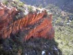
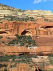
Canyon "B" is one of several canyons slicing deep into the Red Rock Secret Mountain Wilderness, west of Sedona. In a series of expeditions in 2007, we located and photographed four archeological sites.
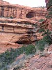
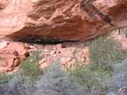
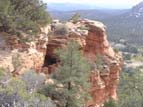
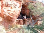
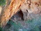
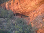
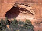
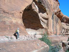
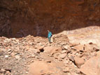
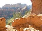
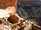
The first ruin in this series (photos 1 through 4, and the title photo above) happens to lie a short hike off one of the several official trails that are maintained in the area. This is typical: the Forest Service has gone to great pains to route trails away from archeological sites in order to protect them from vandalism, looting, and simple wear and tear from too many tourists. This first site actually contains several ruins: Photo 1 shows two of them, one clearly visible in the lower cave and one in the upper cave that is not quite visible from the valley floor. The only way to get to the upper ruin is to circle around to the next draw, climb up the scree slope, and follow a series of narrow ledges that are halfway up the cliff face back around into the first canyon--a tricky hike and not for the faint of heart. The lower ruin, however, is easier to get to.
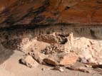
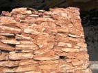
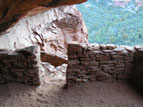
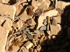
Photos 2 and 3 show the site from different angles. Examination shows that only the right-hand portion of the structure retains the mud mortar originally used to stabilize the rock walls. The other walls are mostly dry (without mortar)--a sure indication that they have been reconstructed in modern times by well-meaning but inexperienced hikers. Only the mortared walls are original, although the reconstruction almost certainly utilized material that had collapsed from the original structure. In this particular site the lowest courses of rock still retain some mortar, indicating that the rebuilders did indeed follow the original floor plan. The last picture (photo 4) provides a detailed look at one of the original walls. In some places, handprints and finger marks from the ancient builders can still be discerned in the mud.
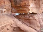
Site 2 is located in the next side canyon to the west of Site 1. To get there you have two choices: you can climb down the scree slope into the bottom of the main canyon and then climb back up again--a hike of about three quarters of a mile and five hundred feet of elevation change--or you can follow the narrow ledge that continues on at the same elevation as the two sites, and pass from one canyon to the next through the narrow slot shown in Photo 5. The slot is about eighteen inches high, and is worn smooth from the slithering of countless stomachs over the ages. Its remote location and the exposure of the approach make it unlikely that many of those stomachs were attached to modern tourists.
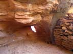
The site itself is small, nestled in a small hollow in the side of the thin ridge that separates the two canyons. This site too has seen some reconstruction, although some original mortar still remaining in the lower courses of stone work, the soot-stained ceiling and the packed, flat floor all indicate its authenticity. This cliff dwelling is unique in that it contains a small natural window in its back wall (photo 7) which would have allowed inhabitants to keep an eye on the canyon on the other side.
The third group of ruins is perched precariously half way up the cliff face under a protective overhang. This group was a good hundred feet below the level I was traversing, and there was no obvious way down that did not involve retracing my route all the way to the bottom of the main canyon, so I was unable examine it closely. A few weeks later, however, I happened to be passing below this site on my way back from another ruin, and just had time for a detour before the sun went down. Photos 10 through 12 show details of the structure. Although there are a few pot sherds present, the walls themselves have been almost completely rebuild.
Topping out on the caprock on one of the many mesas in the area revealed this impressive complex built into the facing side of the cliff across the next canyon. Photos 13 and 14 were taken from nearly a mile away and show limited detail, but having had the benefit of a good pair of binoculars I was able to determine that there is indeed a structure there.
The site is located in a rugged and trailless area quite high up the side of the nearly vertical cliff, and is completely invisible from the canyon below. As far as I can determine, the only place from which it can be seen from any distance is the mesa top from which the first two photos were taken, which is a fairly inaccessible place in its own right. Because of this, two subsequent attempts to reach the ruin were not successful. On a third attempt, however, I finally found the way up. Surprisingly, the route is not up the talus slope visible below the cave in Photos 13 and 14, but from the west (left) side, along the narrow ledge shown in Photo 15.
The ruin itself is fairly small, but the amount of collapsed building material on the cave floor indicates it was once much more extensive. On first approach, I was disappointed to see that the remaining walls apparently had no stabilizing mortar, which is generally an indication that the structure is not original (Photo 16). The back sides of the walls, however, do retain the original mortar (Photos 17 and 18). It is likely that, despite the protective overhang, enough rain has been blown inside the alcove over the last seven hundred years to slowly erode the outward-facing mortar while leaving the less exposed inner surfaces intact.
Of all the ruins described so far, this one was the least disturbed. Pot sherds littered the floor, as well as the remains of maize (corn cobs), lying just as they had been left by the original inhabitants in the 14th century (Photo 19). Maize was the primary source of food for most pre-Columbian societies in the southwest, and is also important from an archeological perspective: Analysis of trace chemicals and isotope ratios (primarily of strontium) has been used to determine the location in which the maize was originally grown, allowing archeologists to reconstruct ancient trade routes. For example, maize excavated from Pueblo Bonito in Chaco Canyon New Mexico and dated to the period between A.D. 850 and A.D. 1241 (9th to 13th centuries) was determined to have been grown up to 90 kilometers away. To my knowledge no such analysis has yet been done on maize in the Sedona region.
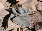
Photo 20 shows a mano (grinding stone) and broken metate (basin) found at the site, which were used to grind maize, pinon nuts and other seeds. Pinon nuts come from the cones of several species of pine trees, in this case Pinus Edulis, which is native to the western United States and Mexico. Stone grit from food prepared in this way was hard on the teeth, a fact confirmed by examination of skeletal remains from the period. The stone from which the metate is made is not normally found in the Sedona area.

